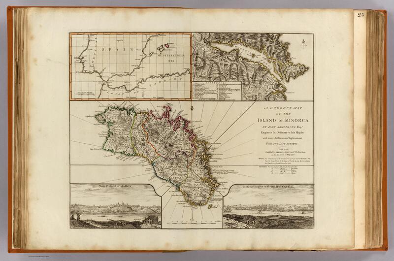
A correct map of the island of Minorca by John Armstrong,
Media
Parte di Minorca. Carte, mappe, disegni
- Titolo
- A correct map of the island of Minorca by John Armstrong,
- Titolo originale
- A correct map of the island of Minorca by John Armstrong, Esqr., Engineer in Ordinary to his Majesty, with many additions and improvements from the late surveys. (with Harbour of Mahon). (with view) North prospect of Mahon. (with view) North east prospect of St. Philips Castle. London, Published by Laurie & Whittle, No. 53 Fleet Street, as the act directs, 12th May, 1794.
- Autore del documento
- John Armstrong
- Descrizione
- Mappa incisa a mano e colorata. Rilievo illustrato per immagini e per cesure. Include una mappa interna.
- Scala
- 1:146,000
- Tipo di rappresentazione
- Atlas Map
- Mappa Atlante
- Rappresentazione tematica
- Isola di Minorca
- Caratteristiche materiali e requisiti tecnici
- cm 45X55
- Esistenza e localizzazione degli originali
- OCLC 7160203. Cf P699; Shirley R. Maps in the atlases of the British Library, T.LAU-1c (1799 ed.); NMM 375 (3rd ed. 1801)
- Autore della riproduzione digitale
- Rumsey Collection
- Formato
- .jpg
- ESC - Ente schedatore
- Giampaolo Salice
- Data di creazione della scheda
- 12 maggio 1794
- Classe di risorsa
- Image
